Terrain Intelligence, Born in the Wasatch
Terrasatch fuses drone flights, LiDAR, blockchain-verified data, quantum-optimized analytics, and snowpack science into a clear picture of your terrain—day or night.
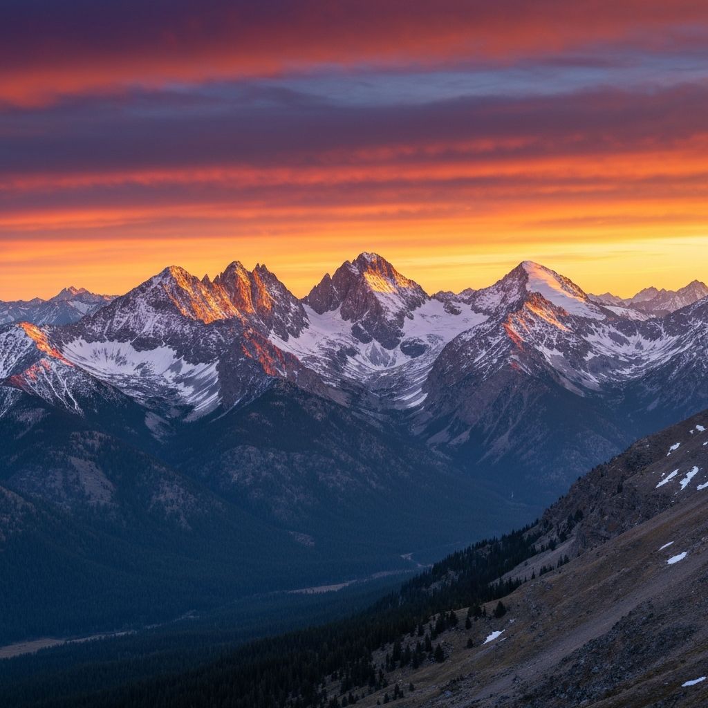
Terrain Intelligence, Built for the Field
Fuse together drone flights, LiDAR data, weather forecasts, and avalanche science into actionable terrain intelligence.
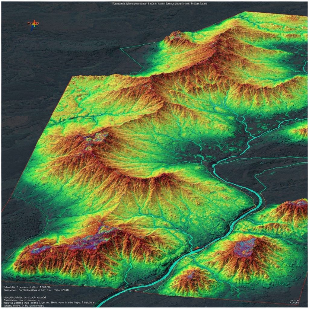
Multi-Sensor Mapping
Drones, LiDAR, and satellite imagery stitched into a single terrain model.
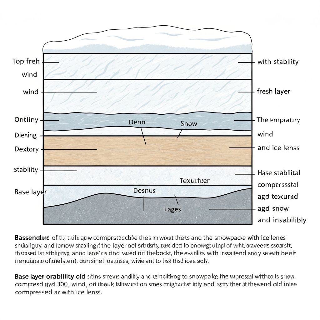
AvyTS – Avalanche & Snowpack
Layer-aware views to understand instability, slabs, and avalanche paths.
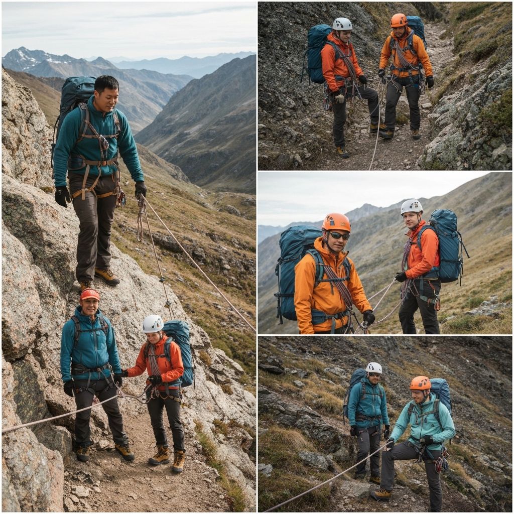
Field-Grade Simplicity
Built for guides, patrollers, and SAR teams—not just analysts.
Always-On Updates
Forecast-informed updates as conditions and seasons shift.
Enterprise Tech Stack
Built on cutting-edge AI, blockchain, quantum computing, and distributed systems to deliver the most advanced terrain intelligence platform available.
AI & Machine Learning
AvyTS neural networks drive terrain classification, avalanche prediction, and real-time pattern recognition across 10,000+ sq mi of terrain.
- Image segmentation
- Hazard prediction
- Anomaly detection
Blockchain Verification
Immutable data ledger for field observations, drone flight logs, and avalanche forecasts. Ensures data integrity and audit trails for compliance.
- Tamper-proof data
- Distributed ledger
- Smart contracts
Quantum Computing
Quantum-optimized solvers accelerate complex route planning, stability modeling, and high-dimensional AvyTS ensembles.
- Route optimization
- Risk modeling
- Forecast acceleration
Real-Time Data Lakes
Live ingestion of drone imagery, LiDAR, weather feeds, and field observations into unified repositories with streaming analytics.
- Petabyte scale
- Sub-second queries
- Auto-scaling
Edge Computing
Edge-deployed AvyTS micro-models process sensitive field data locally with offline-first sync for remote backcountry teams.
- Offline operation
- Local processing
- Auto-sync
Starlink & LEO Backhaul
Dual-dish Starlink plus Ka/Ku-band LEO uplinks keep telemetry, HD video, and AI updates flowing with resilient, low-latency transport.
- <50 ms latency
- Automatic failover
- Encrypted tunnels
Wireless Mesh & LoRa
Self-healing mesh nodes, LoRaWAN beacons, and microwave relays push situational awareness across ridgelines when fiber and cellular disappear.
- Multi-band radios
- 5-20 mi LoRa reach
- Mesh failover
AI Radio Comms
An AI-driven SDR stack tunes spectrum, prioritizes mission-critical packets, and bridges voice-to-data channels for patrols and SAR units.
- Dynamic channel hopping
- Voice/data fusion
- Signal diagnostics
API-First Architecture
RESTful and GraphQL APIs expose AvyTS outputs, live telemetry, and decision logs so partners can embed Terrasatch into any workflow.
- REST & GraphQL
- Webhooks
- SDK support
How the Stack Moves Data
Capture flows from sensors to AvyTS inference, crosses AI-managed radio mesh, then rides Starlink backhaul into cloud data lakes before streaming out through APIs.
Sense & Capture
Drones, LiDAR, satellite imagery, and field kits collect terrain, snowpack, and weather data every pass.
Edge AI & AvyTS
AvyTS micro-models score hazards on-ridge, even offline, while edge nodes compress data for uplink.
AI Radio Mesh
Wireless mesh, LoRa, and SDR radios auto-route packets, voice snippets, and alerts across the patrol area.
Starlink / LEO Backhaul
Multi-link Starlink and LEO channels push synchronized datasets into the cloud with redundancy.
Cloud Intelligence & APIs
Data lakes, quantum solvers, and APIs redistribute insights to dashboards, partners, and automation hooks.
Specialized Modules
Terrasatch Modules: Five Specialized Intelligence Systems
Each module shares the same drone, LiDAR, GPR, and GIS foundation while delivering targeted analysis for specific hazards. AvyTS (AvyTerraSatch) remains the flagship research pilot, pushing the pace for every other module in the stack.
Terrasatch Module
AvyTS – Snow & Avalanche
Real-time snowpack modeling, weak-layer detection, and slope stability scoring powered by the flagship AvyTS research program.
- Snowpit Reconstruction
- Storm-Cycle Timeline
- Weak-Layer Detection
Terrasatch Module
GeoTS – Geology & Rockfall
Geological mapping, rock anchoring intelligence, and rockfall path modeling that combine morphology, subsurface data, and historical activity.
- Slope Stability
- Rockfall Paths
- Geological Mapping
Terrasatch Module
HydroTS – Water & Hydrology
Watershed modeling, flood forecasting, and streamflow prediction built on synchronized elevation, precipitation, and groundwater telemetry.
- Watershed Analysis
- Flood Modeling
- Water Resources
Terrasatch Module
PyroTS – Wildfire
Fuel load assessment, burn-scar mapping, and live spread modeling using multispectral imaging fused with terrain-aware weather inputs.
- Fire Risk Scoring
- Burn Mapping
- Fuel Analysis
Terrasatch Module
InfraTS – Infrastructure & Environmental
Asset monitoring, inspection automation, and environmental compliance scoring for roads, utilities, and sensitive sites.
- Asset Monitoring
- Infrastructure Inspection
- Environmental Compliance
Core Capabilities
Terrasatch Technology Stack
Integrating drones, LiDAR, GPR, GIS, and AI/edge connectivity to deliver comprehensive terrain intelligence from capture to command.
Drone Mapping & Photogrammetry
High-resolution aerial capture for corridor mapping and rapid situational awareness.
LiDAR Elevation & 3D Surface
Centimeter-grade elevation, slope, and aspect models for engineering-grade analyses.
GPR Subsurface Intelligence
Ground-penetrating radar reveals layer density, permafrost, and buried structure changes.
GIS Multi-Layer Intelligence
Unified stack of terrain, vegetation, infrastructure, and hazard overlays.
Real-Time Data Fusion Engine
Continuous ingestion of drone, LiDAR, GPR, and IoT feeds into a single decision graph.
Terrain Modeling & Hazard Scoring
Probabilistic risk modeling delivers zone-by-zone hazard scores and playbooks.
AI/AR Visualization HUD
AI overlays for mobile, AR goggles, and command nodes to highlight hazards and safe corridors.
Starlink Remote Sync
Off-grid Starlink and LEO backhaul keep data flowing from remote valleys and ridgelines.
Blockchain + Quantum-Safe
Immutable audit trails secured with quantum-resistant hashing and key management.
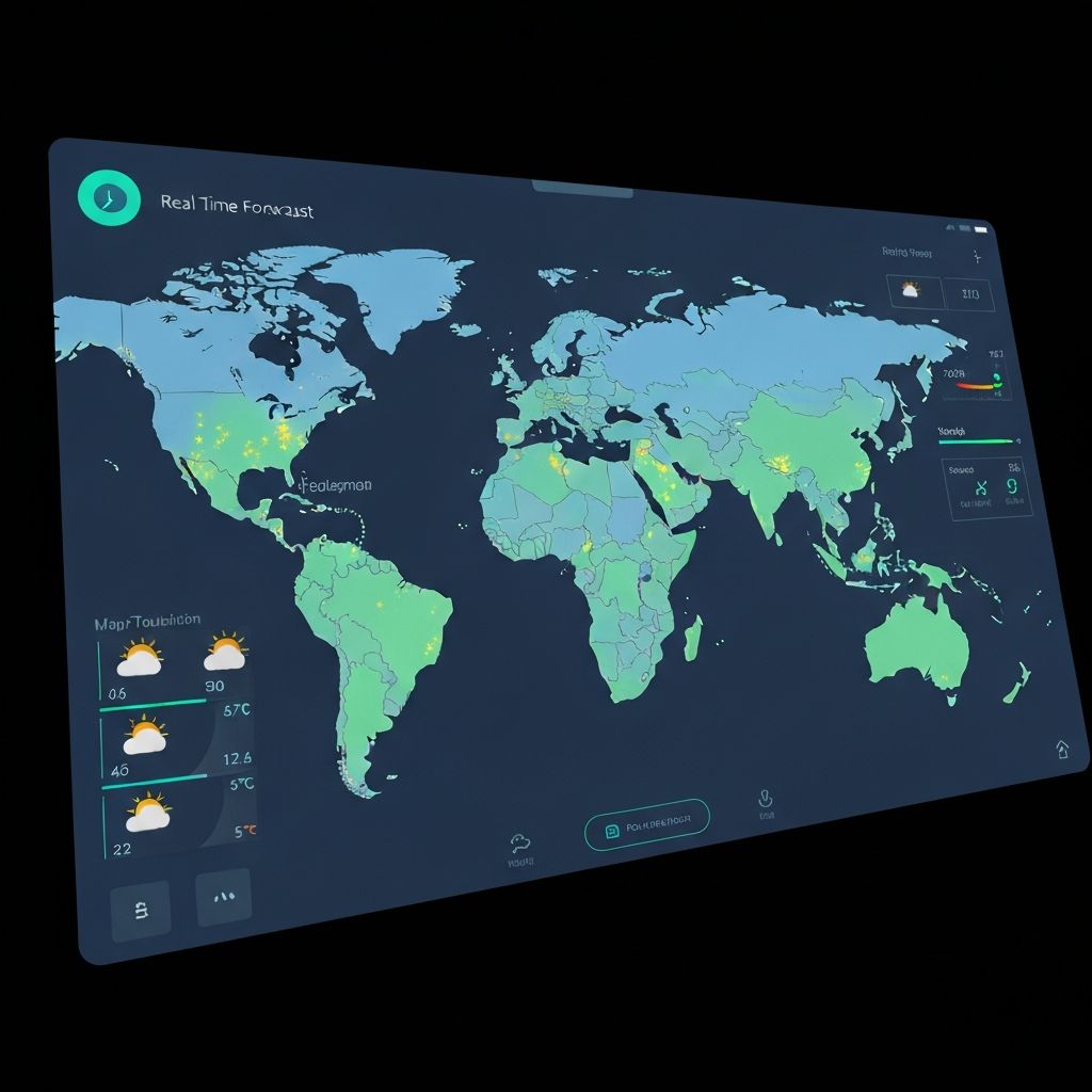
Real-Time Data & Metrics
Live analytics dashboard showcasing terrain coverage, hazard distribution, stability trends, and partner ecosystem engagement.
Square Miles Mapped
10,000+
Western US terrain coverage
Active Partners
50+
Ski resorts, SAR, avalanche centers
Daily Forecasts
720+
AvyTS-powered predictions
API Calls/Day
2.3M+
Real-time data access
Coverage Expansion & Forecasts
Hazard Level Distribution
Weekly Stability Index
Trusted by Field Leaders
Terrasatch powers decision-making for 50+ organizations across skiing, rescue, forecasting, and land management. Partners tap into our API and data streams for more accurate, faster operations.
Ski Resorts & Patrol
Using Terrasatch for daily briefings, hazard mapping, and controlled slope management
Alta Ski Area
Snowbird Resort
Grand Targhee
Jackson Hole
Search & Rescue Teams
Rapid terrain analysis and operational planning for mountain rescue
Utah SAR Coordination
AMRG (USSA)
Alpine Rescue Team
Mountain Rescue Aspen
Avalanche Centers
Leveraging AvyTS analytics and forecast integration for regional warnings
Utah Avalanche Center
Bridger-Teton Avalanche
Colorado Avalanche Info
Sierra Avalanche Center
Tech & Integration Partners
Building on Terrasatch APIs and data streams
Esri ArcGIS
OpenWeather
Sentinel Hub
Mapbox
Partner with Terrasatch
API Access
RESTful and GraphQL endpoints for accessing real-time terrain data, AvyTS hazard overlays, and field observations.
Data Feeds
Subscribe to live data streams for drone imagery, LiDAR processing results, and forecast-aligned AvyTS updates.
SDK Support
Native libraries for Python, JavaScript, and Go. Full documentation and sandbox environment for development.
Purpose-Built for Every Team
Whether you run a patrol, guide in the backcountry, respond to emergencies, or manage terrain, Terrasatch scales to your mission.
Ski Resorts & Patrol
Hazard mapping and daily briefings with AvyTS overlays
Explore →Backcountry Guides
Education, route planning, and field operations
Explore →Search & Rescue
Fast terrain analysis and rapid planning
Explore →Avalanche Centers
Leveraging AvyTS analytics and forecasting
Explore →Land Managers
Comprehensive terrain tracking and ecosystem insights
Explore →Wildfire Response
Real-time hazard assessment and evacuation planning
Explore →Wasatch-Born, Field-Tested
Terrasatch was born from a Utah local founder who worked as a guide and field operator throughout the backcountry. After years navigating the Wasatch, Little Cottonwood, and Southern Utah terrain, we saw a critical gap: the world's best GIS and AI tools were built for analysts, not field teams.
We built Terrasatch to bridge that divide—combining powerful drone mapping, LiDAR, and snowpack science with the simplicity field operators actually need.
The avalanche engine started as Avalyze and now lives inside Terrasatch as AvyTS (AvyTerraSatch)—a powerful layer for understanding snowpack dynamics and avalanche risk with unprecedented detail.
"Our roots run deep in the Wasatch. Our scope spans the entire West."
Founded in Utah
Field-tested across the Western ranges
50+
Field Partners
10,000+
Square Miles Mapped
99.9%
Field Uptime
Layered Intelligence Architecture
Terrasatch is built as a stack of interconnected layers, each adding critical context for field decision-making
TerraGrid – Base Layer
Unified terrain model from LiDAR, satellite DEMs, and drone orthomosaics. The foundation for all analysis.
AvyTS – Avalanche & Snowpack Layer
Avalanche and snowpack intelligence powered by the original Avalyze engine. Visualize slabs, weak layers, terrain traps, and historical patterns with terrain-aware detail.
Ops Layer – Field Routes & Notes
Guides, patrollers, and SAR teams log real-world observations, photos, and route conditions. Ground truth captured and shared in real-time.
Signal Layer – Alerts & Forecasts
Custom alerts per zone, ridge, or route, driven by incoming data and AvyTS hazard logic. Stay ahead of changing conditions.
Interactive Wasatch Front Mapping
Explore real-time terrain data, avalanche zones, ski areas, and weather stations across Utah with our AI-powered chat assistant.
Live Map & Data Integration
Real-time terrain visualization with AvyTS hazard analysis overlays and field-captured observations
UAC-style reporting formats
ArcGIS / QGIS exports
Drone data ingestion (GeoTIFF, LAS/LAZ)
Real-time data streams
Field observation logging
Multi-team collaboration
Bring Terrasatch to Your Terrain
We're onboarding early partners across the Wasatch and beyond, with AvyTS available for avalanche-focused teams. Join the field revolution.
Important Safety Notice: Terrasatch and AvyTS are powerful decision-support tools, not replacements for avalanche education, proper training, or sound judgment. Always follow local advisories, travel with certified avalanche education, and use appropriate equipment.